This mini feature showcases one of the eighteen open submission portfolios selected for inclusion in our printed journal based on the theme of the right to roam
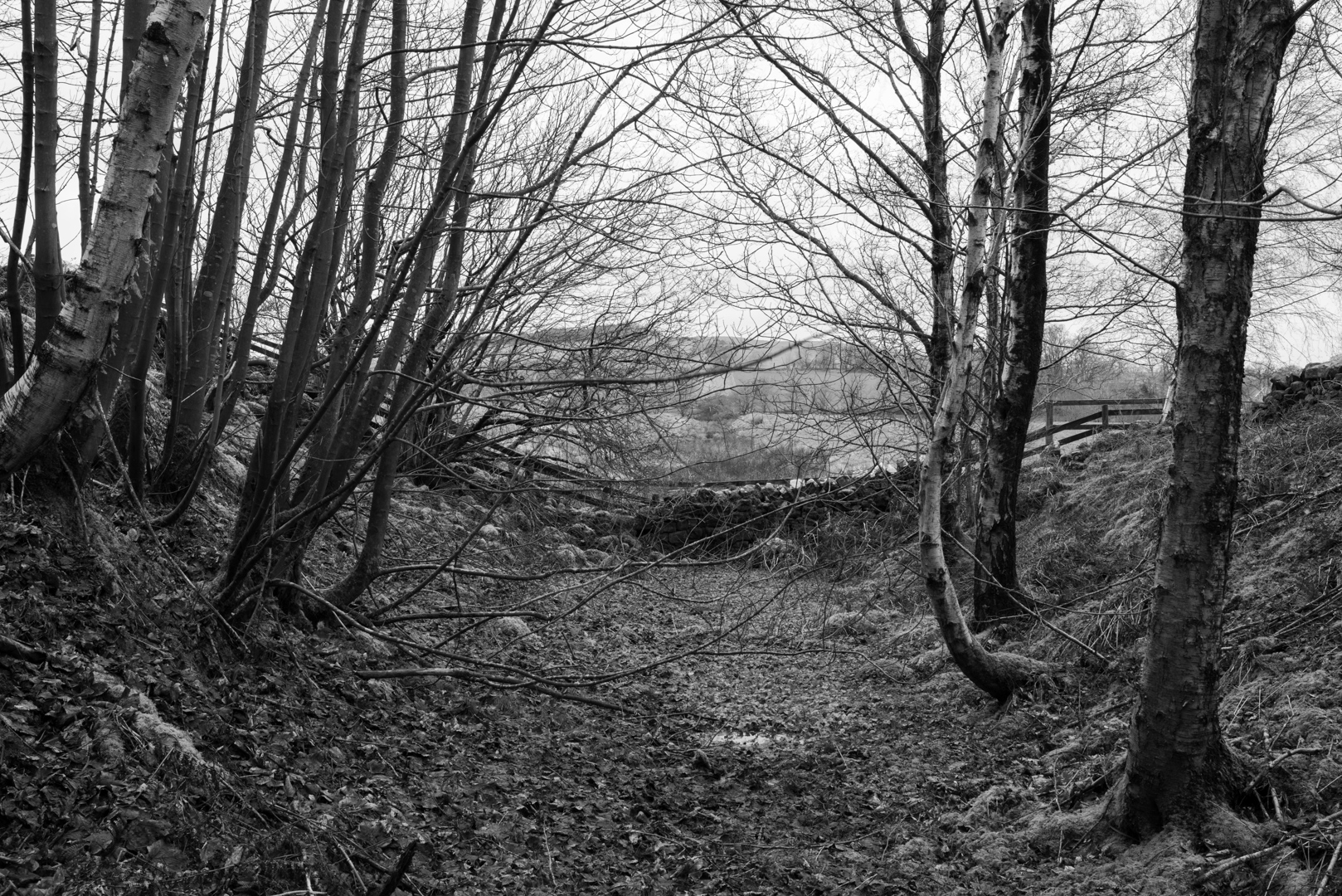
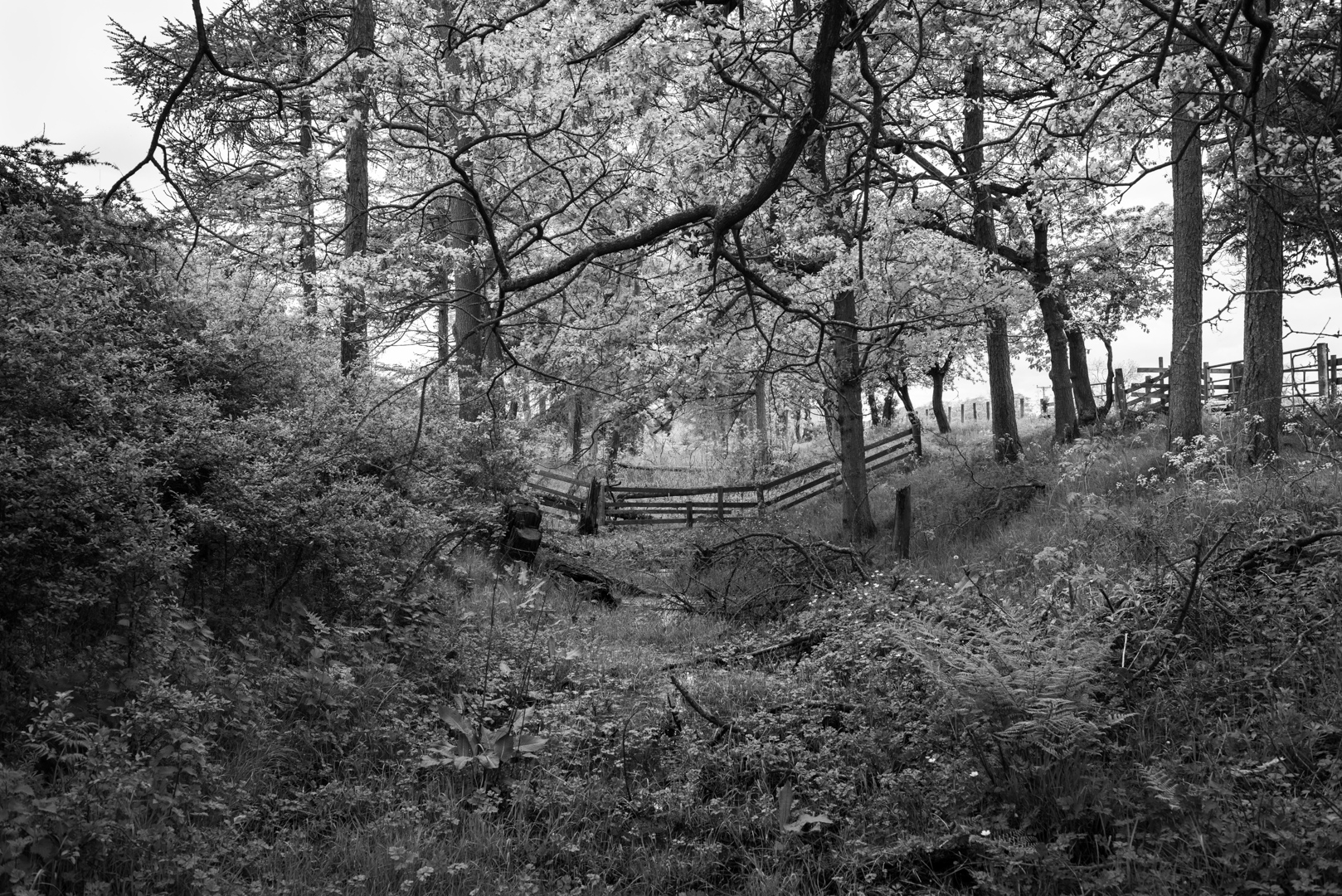
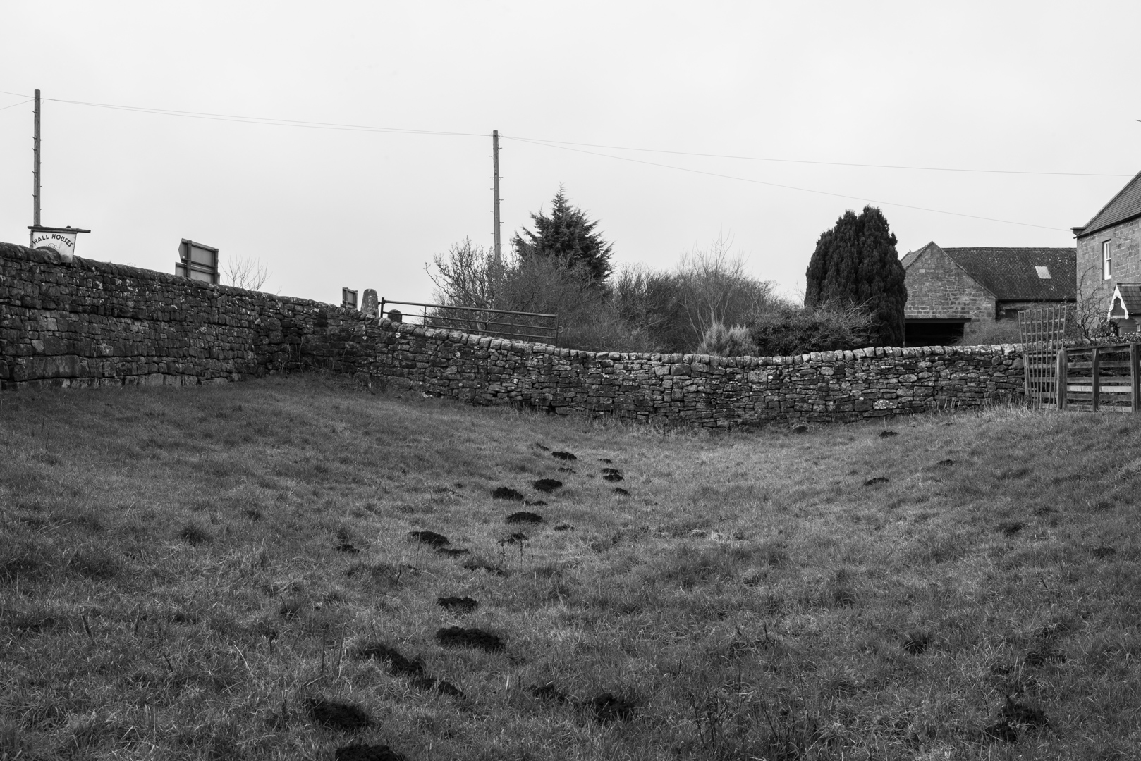
Inspired by topographical survey photographers of the mid to late Nineteenth Century, I’ve been carrying out my own photographic documentation of a man-made ditch that runs along sections of the Roman Wall in northern England.
On the northern frontier of the Roman Empire the ditch was dug immediately to the north of Hadrian’s Wall as a first line of defence. The wall itself ran the width of the country, and was built to defend Roman ‘Britannia’ from the northern tribes. It certainly marked the Roman’s failure to conquer the inhabitants of northern Britain.
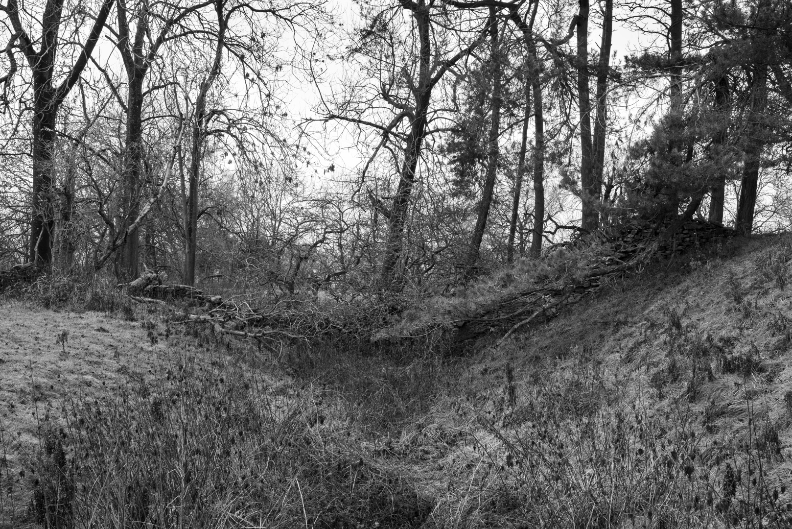
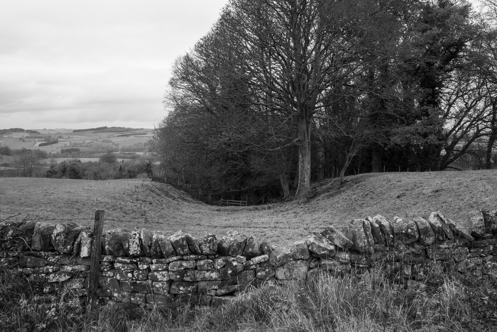
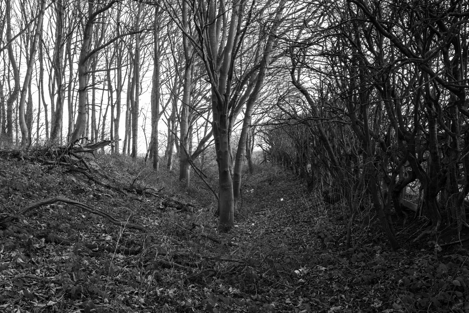
Incredibly, after almost two thousand years, long sections of the ditch have survived relatively intact and are still visible today running parallel to the Military Road in Northumberland. Other sections have all but disappeared under farmland, or have been built over by roads, housing, farms and a pub car park! Some parts of the Ditch run into woodland and its traces can still be found if searched for.
Much of the Ditch (Should be either ‘The Ditch’ if a proper name or ‘the ditch’ if not) is on private land, owned by farmers or large estate landowners. It doesn’t always mark the designated path of the Roman Wall, and in these ‘hidden’ (often beautiful, sometimes not) sections, there is no accessible public right of way and is almost entirely inaccessible. To gain access to the ditch in these parts, means climbing over barbed-wire fences and clambering through dense thorn-bushes and brambles.
Even once in the ditch there are the regular obstacles of walls and fencing cutting across its path, topped with the ubiquitous barbed-wire. These unique archaeological stretches are worthy of investigation, but it takes some determination to access. And there is the constant worry of being challenged by a landowner for tresspassing.
Contemporary thinking suggests that the construction of Hadrian’s Wall was about far more than a solid fortification, separation and violence and that this zone was more complex. The border was far more fluid than once thought, with people moving to and fro. As well as a demarcation of empire and for defence, the wall also acted as a customs border; a way of monitoring and controlling who passed through.
The Roman’s desire to assert control through territorial boundaries has been given renewed currency by present-day geopolitics – from the Israeli-Gaza Strip barrier, the Turkey-Syrian border wall and Trump’s Mexican wall, through to Scottish independence, Brexit and the Irish border.
Photography itself was a tool of imperialism, playing its part in the global expansion of European and American power. It was an important instrument of scientific exploration – mapping and recording unknown territories – while also serving political and commercial ends (which inventively ended in the displacement and genocide of indigenous peoples).
These photographs of the ditch (and the inherent challenge in taking them) resonate with the past – echoing with notions of the ‘frontier’ and everything that conjures up: restriction of movement, separation and fear. But they also speak of the complexities of identity, cultural tolerance and freedom of movement – the right to roam.
The full set of images from the open submission are shown below (click to view image larger in the original format).
Website: damienwootten.com
Instagram: @damienwootten
CREDITS
Unless otherwise stated, all words and images in this article are © Damien Wootten
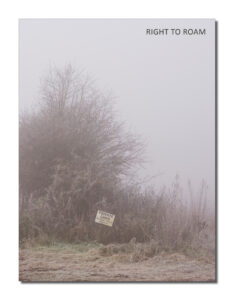
THE JOURNAL
Our biggest, most content packed, and socially current publication to date, exploring the theme of the right to roam. Featuring an introduction by our very own co-founder Rob Hudson and a selection of work from 37 contributors, including the one featured above. Click on the image of the journal cover below to take you to the journal’s information and ordering page.